You cannot stay on the summit forever; you have to come down again. So why bother in the first place? Just this: What is above knows what is below, but what is below does not know what is above. One climbs, one sees. One descends, one sees no longer, but one has seen. There is an art of conducting oneself in the lower regions by the memory of what one saw higher up. When one can no longer see, one can at least still know.–René Daumal
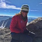
I am back in the “lower regions,” but still thinking about what I saw up high. As I write this, I’m still exhilarated from an adventure I experienced in my backyard, Wyoming’s Wind River Range, this past weekend. As you have gathered by the many blog posts I’ve published here, I spend a lot of time in Wyoming’s Wind River Range, which is essentially my “backyard.”
This blog post is my attempt to share about what I consider to be one of my most memorable Wind River epic adventures – time in Indian Basin and a climb up Fremont Peak. I apologize in advance for the blog post’s long length. But, as the saying goes, I would have made it shorter, but I didn’t have the time.
I put this adventure together at the last minute when a work trip was cancelled. I invited my dear friend, Kathy Swanson, to accompany me, and she said Yes.
I only had three days, and I wanted to climb Fremont Peak. I also wanted to experience the Indian Basin region, which I had read about in numerous stories and trip reports related to the Titcomb Basin region. My friend, and well-known adventurer and writer, Mark Jenkins, wrote about Indian Basin in a Backpacker article called “Perfect 10–North America’s 10 Most Memorable Hikes, “I’ve hiked trails from Tibet to Timbuktu and found nothing more gorgeous.”
And in 2012, my husband, Jerry, and I had taken a long day hike to Island Lake. I remember taking in the views of the lake, and being awe-struck by the big mountains beyond the lake, which include Fremont Peak. I promised to one day return so I could go deeper into the area. Last weekend was my chance.
The plan was to backpack in about 15 or so miles on Friday to Indian Basin, where we’d camp for 2 nights. On Day 2/Saturday, we’d climb Fremont Peak, and on Day 3/Sunday, we’d backpack back out.
Fremont Peak is the third tallest peak in Wyoming, and the second tallest in the Wind Rivers. At 13,745′ tall, it’s just 64′ lower than Gannett, the tallest, and 31′ lower than the Grand Teton (which I’ve also climbed). Fremont Peak is the tallest peak in Wyoming that doesn’t require technical skills or gear. The main reason I wanted to climb it is because directly on the other side of it (on its north side) is Upper Fremont Glacier, one of the largest and last remaining glaciers in the American Rockies. I couldn’t wait to look over the other side of the mountaintop to see that for the first time.
We started at the popular and well-used Elkhart Park trailhead near Pinedale, WY. We started up the Pole Creek Lakes trail with our too-heavy backpacks at 6am, and made great time. After about four-and-a-half miles, we took our loads off and snapped some photos at an overlook called Photographer’s Point. “There’s Fremont Peak,” I told Kathy. “That’s the mountain we’ll climb tomorrow.” She didn’t say anything, and I think she purposefully looked away from the view at that point. At a little over five miles, we continued on the Seneca Lake Trail.
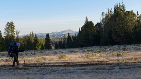
A major highlight of this route are all of the lakes you pass. We hiked past Eklund Lake, an unnamed lake, and Hobbs Lake, before reaching the stunning, and rather large, Seneca Lake.
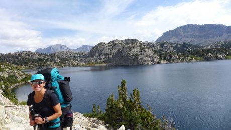
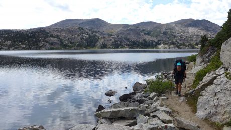
The views of the mountains from Seneca Lake warrant a break, so we removed our packs and enjoyed a lunch break here before refilling our water bottles and continuing up. Shortly after Seneca lake, we hiked past Little Seneca Lake, and soon after, crossed over the Continental Divide Trail and continued up and toward Island Lake and Titcomb Basin.
At about 11 miles, we reached Island Lake. Seriously – this is such a spectacular scene I always feel like I have to check the map to make sure we’re not in Heaven. It’s that spectacular. We took our loads off here briefly to take some photos and enjoy another snack. I also commented about the clouds over the mountains, which were building up pretty quickly. I knew there was a chance for some weather today, but was hoping we’d reach our destination before it came to pass.
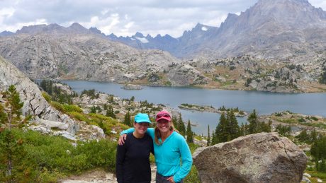
I should probably mention here that Kathy doesn’t consider herself a backpacker, nor does she want to be one. She’s a phenomenal athlete, and is very adventurous, and we share a love for long distance day hiking. Kathy and I both “grew up” in Lander, WY, but she’s a year younger, and while we had some friends in common in those early days, we weren’t very well acquainted. It wasn’t until she read about my Grand Canyon rim-to-rim-to-rim, and other epic day hikes, that she reached out to me. That was about six years ago, and Kathy and I have since shared the trail on many epic adventures, mostly epically long day hikes.
But back to the point I was trying to make a minute ago… Kathy pretty much only backpacks when I invite her on one of these trips. In 2012, I roped her into going on a 3-day backpacking and mountain climbing adventure with me, along with two other friends. The adventure served as a sort of “test drive” for a portion of my Epic Women expedition’s route. She was a great sport, even if she didn’t fall in love with carrying a backpack, “camping” without lawn chairs and a cooler of beer, and climbing mountains. (We climbed Mitchell Peak from Lizard Head Meadows, and she was terribly uncomfortable with every step, and although she did amazing, I wasn’t sure I’d ever find myself leading her up another mountain.)
The night before this adventure, when Kathy tried on her borrowed – and loaded – backpack, she remarked with a few choice words I don’t want to print here, along with “my knees just buckled.” She wasn’t joking. Did I mention Kathy is a trooper? She’s one of the very few friends I call when I have something this epic planned, and on short notice. So far she has always said Yes. But for the record, and to be completely up front, had she said No, I still would have set out on this adventure. That’s how bad I wanted to experience Indian Basin and Fremont Peak. That said, I was thrilled I had a taker in Kathy, because we always have meaningful conversations, a lot of fun and laughter, and we both love pushing our limits.
The reason I’m bringing this all up right here is that a little bit past Island Lake, about 11.5 miles into our backpacking adventure, I could sense that Kathy might be approaching that threshold at which things start to go downhill, and it’s not a lot of fun anymore. This has nothing to do with her fitness level and everything to with her borrowed, and heavy, backpack. Oh, and add to that she was experiencing significant pain in one of her ankles caused by her hiking boot.
All that said, Kathy is one of the toughest people I know, and she has a awesome attitude. About this time I was also worried about the clouds that were developing, and how torrential rains and prospective thunder and lightning might wear on her (us) should those conditions present themselves.
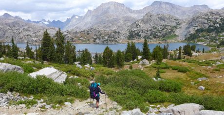
After hiking down to, and around, Island Lake, we made our way up the trail to the Indian Pass junction. Here, we took a right and headed toward Indian Basin. Shortly after the junction, we came upon a young couple, and I asked them if they had been in Indian Basin. They said Yes, and then they asked where we were headed. I told them we were headed into Indian Basin, and that we had plans to climb Fremont Peak the next morning. They shared that they had climbed it earlier in the day.
Before our trip, I had talked to a couple of friends (Hank Williams and Gabe Joyes) about climbing Fremont Peak. Each of them told me that Fremont Peak was a “walk up,” and that I’d have no problem. I believed them, but was still interested in hearing a first-hand report from strangers. The couple, who was visiting from Grand Junction, CO, told us that the route up the SW buttress was pretty straight-forward, but that there were some pretty hairy sections that were loose, and some “Class 4” terrain. “But I’m sure you’re experienced, and will have no problem with it.” I felt assured by this, and yet the Class 4 comment wasn’t something I was expecting. Everything I had read about the SW route to Fremont Peak was that it was Class 3. I filed that interesting tidbit in my mind, but didn’t mention anything to Kathy, who was already terrified at the prospects of climbing a mountain. Before we parted ways with the couple, the man mentioned that there were some established sites protected by boulders in Indian Basin that we should look for, adding, “It’s a bit of a climb into Indian Basin.”
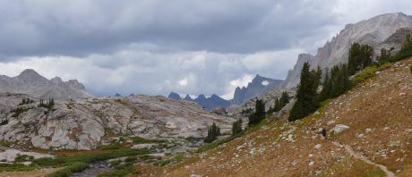
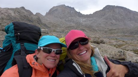
That “bit of a climb” the man mentioned to us felt like Jackass Pass, one of my favorite high altitude trails and passes in the southern Wind Rivers near the Cirque of the Towers. Normally a high pass wouldn’t be that challenging for us, but this was coming to us with about 14.5 miles already on our legs, and too-heavy packs on our backs. Oh, and did I mention that those developing clouds were now expressing themselves? At this point, at about 2pm on on Aug. 26, the skies were spitting snow on us. Awesome.
We sucked it up, and continued hiking up the trail in lightly falling snow. I stopped to capture a quick video and take in the moment. Although I would have preferred blue sky, the scene felt magical. When snow falls on an August epic adventure, it makes the whole experience more unforgettable. Kathy and I both agreed that snow was better than rain, and continued, but only after Kathy remarked, “Living the dream.” She took the words right out of my mouth.
Finally, we arrived at Indian Basin, and found a protected and established site for our tent that was up against a rock wall, at about 11,500′ elevation. I instructed Kathy to remove her pack, bundle up with some layers and warmer gloves, and to eat a snack and drink some water. Not to brag, but I set up our tent in record time. As I did so, it wasn’t snowing as much as “spitting”on us. We quickly inflated our sleeping pads, and placed our sleeping bags in the tent. As soon we both climbed in to get horizontal, and out of the elements, the snow really came. (See the video below for proof!)
Suddenly we couldn’t see the lake that was in front of us, or the mountains. (I think Kathy preferred it that Fremont Peak wasn’t visible because it was easier to keep it out of her mind.)
Because we had started our adventure early in the day and made good time, it was only 3pm as we rested in our tent while the snow fell.
“Well that was a solid 9 hours of exercise we had today,” remarked Kathy. I laughed at her choice of words – “solid”– to describe our 15.5-mile trek in with too-heavy packs on our backs, and a route that included 3,500′ of elevation gain. (My FitBit recorded 44,000 steps for the day.)
Kathy rested her sore neck, shoulders and legs, while closing her eyes. As for me, I reached for my book, Consolations, by David Whyte, and read two of his amazing essays in that book, Gratitude, and also, Beauty.
About one hour later, I unzipped the fly, and peeked out. The snow-filled air was gone, and blue sky was emerging. We could see Fremont and Jackson peaks. Yeehaw! I thought to myself.
I made an early Epic noodle dinner for us, and we ate it with gusto. I would share more about the recipe, but it’s complex, and I don’t want to give away my secret wilderness recipe.  We called it a night when it was still light out, and woke up (from not sleeping!) at around 4am.
The big day was here. We were going to climb Fremont Peak. I love to start mountain climbs before the sun comes up. This is for the obvious reason. Starting early provides us with a bigger window and opportunity to climb a mountain in a place where weather can change quickly. The second reason, though, is I love to be under way when the sun comes up, and to experience alpenglow on the peaks we’re approaching. However, because this was all new country for me, and given Kathy’s – to use her words – “dread,” we opted to depart camp at first light so we could better see the terrain. So I had an extra two or three cups of coffee, while Kathy enjoyed a double hot chocolate, and we ate our breakfast bagels.
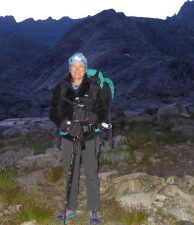
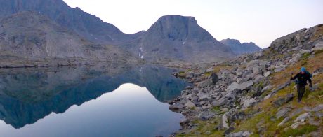
We had instructions from everyone I consulted with before this trip to head for the grassy saddle below Fremont Peak, so from our camp, we started traversing a slope at an angle oriented toward the top of the saddle. The lakes we passed were like mirrors – still, and reflecting the mountains above them.
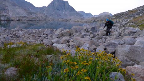
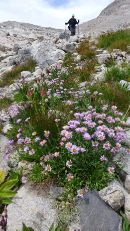
I didn’t expect to see many wildflowers on this trip since it was late August, but we were pleasantly surprised.
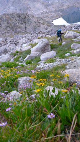
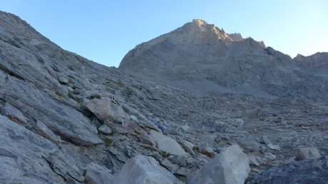
As we approached the saddle to Fremont Peak, the terrain was mostly rocks. We acted like mountain goats and made pretty good time getting to its top. Once at top of the saddle, we took some photos and I captured a short video. We snarfed a snack and guzzled some water and then found a trail, and followed it toward Fremont’s S/SW face.
Here’s a video of our view from Fremont’s saddle:
The “trail” petered out shortly due to the terrain being mostly rocks and not dirt or tundra. We spied some boot tracks here and there and used those to link routes up the mountain.
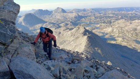
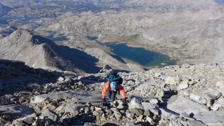
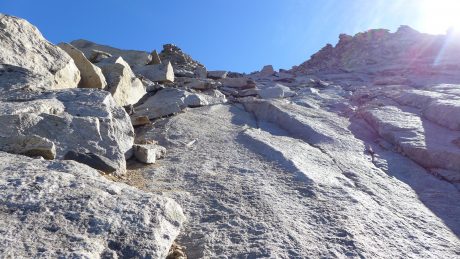
The first Wind River mountain I climbed was Wind River Peak (which I’ve climbed two times, including in a day with my husband as a birthday present for me in 2012.) I have since climbed many peaks in the Wind Rivers. I don’t choose peaks based on their height or popularity. Rather, I’m looking for unique experiences, and often, those experiences include climbing a peak. And I won’t lie, I am always curious about what it looks like from the top, and “on the other side.”
Near the beginning of the climb up Fremont, when we stopped to find sections to piece together into a route, I found myself reflecting a bit on the previous mountains I had climbed. I remembered I was only 28 when I climbed Wind River Peak that first time. Today, I’m 48. That’s not helpful right now, I thought to myself. I’m not very young anymore. This caused me to recall a conversation I had recently with a friend, who is also 48, and how I reminded her, “You’re only 48.” I am so grateful for my health and abilities. To reassure myself, I recalled all of the hard training I have done throughout the year so I can embark on adventures like this one.
As I carefully selected routes, I was pushing my mental limits, feeling very aware of Kathy’s discomfort and fear, and also managing some of my own fears. One thing I’ve learned is that most, if not all, of us have an inner critic, and that critic usually shows up when we’re stretching our abilities. Instead of supporting us and encouraging us, our inner critic beats us down in an effort to get us to retreat “to safety,” to the status quo, to our comfort zones.
The climb was not above my abilities, but the stakes in the wilderness, and up on mountains, are high, and I was constantly aware of what those stakes were, as well as Kathy’s trust in me. This made me a little teary-eyed, but (thankfully) my sunglasses concealed my emotions. I was part fearful, but mostly feeling blessed that someone would trust me enough to follow me. This caused me to be grateful for all of the people who sign up to work with me and follow me into the wilderness, and sometimes up mountains. That’s a lot of trust, and I don’t take it lightly.
With only a few steps (moves) to reach the summit, I was filled with anticipation. I couldn’t wait to see what was on the other side. I love this stage of a mountain climb – when the summit is in reach, and you’re about to stand on it. Full of potential is how I would describe this state. I couldn’t wait to get a look at the Upper Fremont Glacier. (In May and June, our family went to Europe, where we explored 7 countries in 30 days. One of many highlights was riding a train to the Gornergrat Glacier, above Zermatt, Switzerland.) I couldn’t believe I was about to get a close-up view of a glacier in my own backyard.
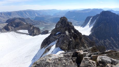
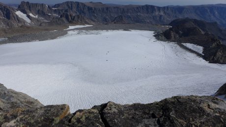
And there it was, before me: Upper Fremont Glacier. I recalled the words of John C. Fremont, for whom this mountain is named. From Fremont’s 1842 Report: “I sprang upon the summit, and another step would have precipitated me to an immense snow field five hundred feet below.” Measuring about 690 acres, Upper Fremont Glacier is one of the highest altitude glaciers in the American Rockies.
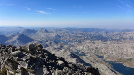
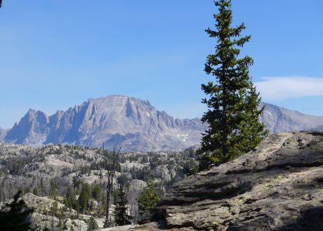
Looking over the summit’s edge at the great expanse of old snow was an experience I’ll never forget. The views from Fremont’s top are panoramic, the scenery in all directions, astounding. In addition to the glacier, we could look up (and down) the Continental Divide and see numerous granite peaks, and also, the many lakes that dot Titcomb Basin and beyond.
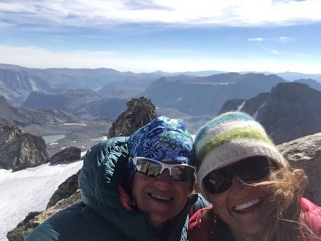
Kathy and I hugged, and congratulated each other before capturing some summit photos and video.
As if often the case in the Wind Rivers, and during other wilderness experiences, I was for a moment moved to tears. I was inspired by the spectacular beauty, feeling fulfilled by our accomplishment, and filled with gratitude. I remembered what I had read in the tent the day before from Consolations. That gratitude isn’t a passive response to something we have been given, and that it arises from paying attention, from being awake in the presence of everything that lives within and without us.
Gratitude is the understanding that many millions of things come together and live together and mesh together and breathe together in order for us to take even one more breath of air, that the underlying gift of life and incarnation as a living, participating human being is a privilege; that we are miraculously, part of something, rather than nothing. (David Whyte)
Kathy was also overcome with emotion, and used my cell phone to call her husband and daughter, and her parents. I also sent out some texts to special people, and then we snarfed some lunch while taking in the experience.
After about 45 minutes, we agreed it was probably time to start down. I always remember that the summit is only the halfway point. We still have to get down off the mountain. And based on our route up, I knew our descent could be more challenging than our ascent.
We took it slow, and I reminded Kathy to be deliberate and to stay focused. I said these words often, and in order for both of us to remember. We took frequent breaks to keep our wits, to breathe, and to look up and take in the views.
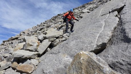
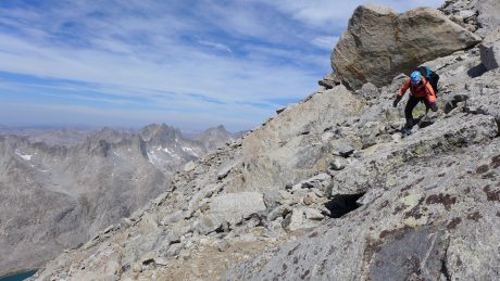
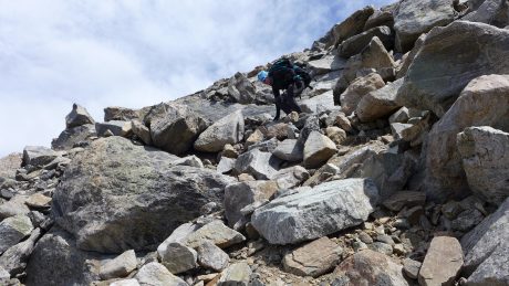
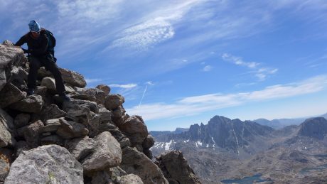
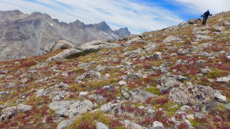
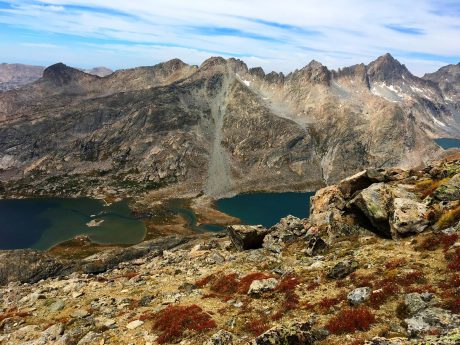
Soon, we were back at the saddle, where now the tundra stood out in its brilliant early Fall colors. There were burnt red patches mixed in with golden tundra, and all around us were greenish-blue lakes, and tall gray granite mountains. The angle of the light on this landscape was breathtaking, and we couldn’t help but stop to soak in the scenery, and to enjoy it for a bit.
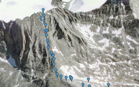
(By the way, I have our route saved as a .kml file. If you have Google Earth, and are interested in the file, please send me a note, and I’ll be happy to share it with you.)
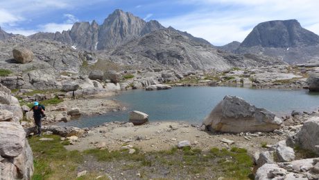
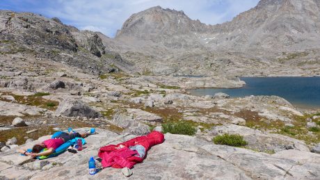
We found the trail, and descended the saddle toward the lakes in Indian Basin, and before long we were back at our tent. It was 2pm, and all we wanted to do was rest. We put our sleeping bags on a flat granite slab, got horizontal, and rested under a blue sky, occasionally looking up at the mountain we had just climbed.
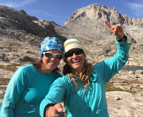
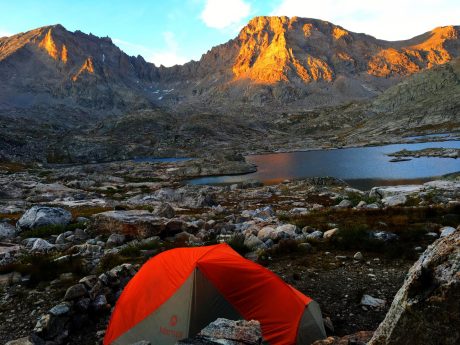
I fixed us some Epic cheesy quesadillas with spicy tomatoes and we had a bit of a “Happy Hour,” made possible by some special treats we had hauled in. We watched as the sun started to set and marveled at the way the sun highlighted the mountain peaks. It was the perfect end to a perfect day.
Morning came early. Our third day would be a big one. We had to pack up our camp, and backpack 15.5 miles to the trailhead, then drive 2 hours to Lander, and then Kathy had an additional 2.5-hour drive to get home to Casper.
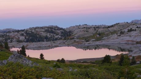
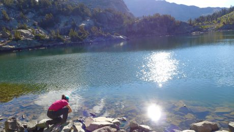
We were on the trail before sun up, and we were rewarded accordingly. There was pink in the sky, and perfect reflections of the pink sky, granite and pine trees in the lake.
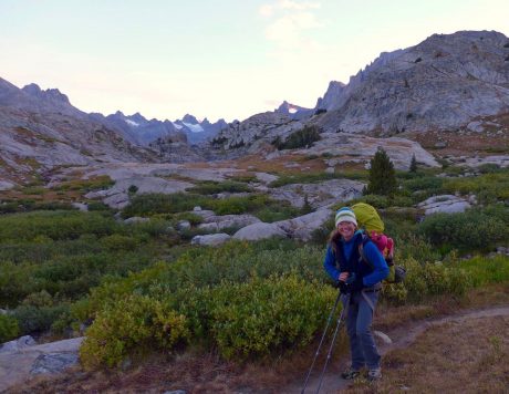
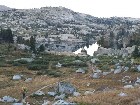
Unfortunately, once at Island Lake, I led us up a wrong trail. We ascended about 300′ and a quarter of a mile before I had a hunch we were on a wrong trail. Fortunately I realized my hunch was correct and we returned to the lake, skirted it for another quarter mile or so, and then ascended via the correct trail.
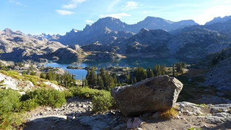
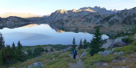
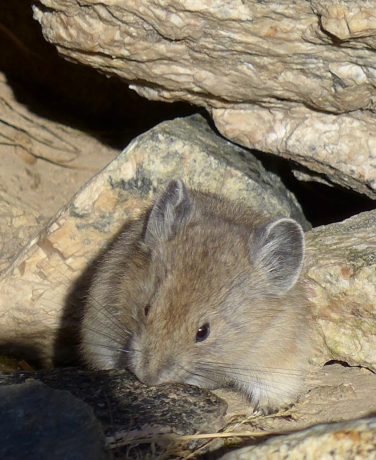
Once above Island Lake, we stopped for one last look at this spectacular scene. It was almost 8am, so I figured I deserved a Snickers. As usual, it was delicious. While stopped, we watched as a cute pika came out from under a rock.
For the last 11 miles, we hiked pretty non-stop. We had places to go, and had got what we came for. We stopped briefly at Seneca Lake to refill water bottles, before continuing the rest of the way out.
We were back at the trailhead, and our truck, by 2pm. We bought some chips and cold drinks in Pinedale and headed to Lander, stopping in Farson to get epic servings of ice cream.
This was an adventure I’ll never forget, and one I highly recommend. If you can, though, add more days to the adventure so you can have more time to experience, explore, and enjoy what is truly a magnificent Wonderland.
We did it this Epic Adventure in three days only because we had only three days of available time, and that is much better than zero days.
Ours was a tall order, and we were lucky to achieve what we set out to experience. You’d think I’d be beat, but instead I feel invigorated and “restored” to whole. Which reminds me of a Rebecca Solnit excerpt from one of my favorite books, Wanderlust: A History of Walking:
“Suddenly I came out of my thoughts to notice everything around me again-the catkins on the willows, the lapping of the water, the leafy patterns of the shadows across the path. And then myself, walking with the alignment that only comes after miles, the loose diagonal rhythm of arms swinging in synchronization with legs in a body that felt long and stretched out, almost as sinuous as a snake…when you give yourself to places, they give you yourself back; the more one comes to know them, the more one seeds them with the invisible crop of memories and associations that will be waiting for when you come back, while new places offer up new thoughts, new possibilities. Exploring the world is one the best ways of exploring the mind, and walking travels both terrains.”
The post Wyoming’s Indian Basin and Fremont Peak – An Unforgettable Epic Adventure appeared first on Have Media Will Travel.