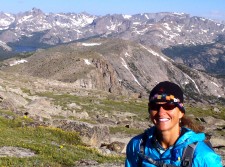
It was very early morning on July 29, when reasonable people were still in their beds sleeping.
Four of my closest girlfriends met my husband and I at our house at 3:09, and by 3:17, we departed for the trailhead at Dickinson Park, about an hour-and-a-half drive. Despite the early hour, as we left Lander, it was 67 degrees outside. A couple miles outside of town, a star shot across the black sky that was heavily dotted with dazzling, sparkling stars. As we approached the trailhead, we watched a small herd of elk cross in a meadow in front of us.
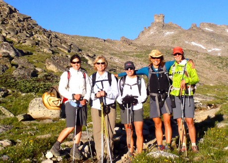
By all indications, the day would be a stellar one.
This “epic adventure” is a trip I planned back in late spring. As readers of this blog know, one of my passions is long distance day hiking, particularly in my backyard, Wyoming’s southern Wind River Range. I love to hike far in a single day, in a landscape whose natural beauty takes my breath away, with people who are positive, interesting, fit, funny, and who are a pleasure to be around. If all goes well, my heart, mind, soul and health benefit.
I feel so strongly about the benefits of this type of epic pursuit that this hike would serve as sort of a “test drive” for a product I plan to offer in my new leadership/coaching business.
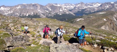
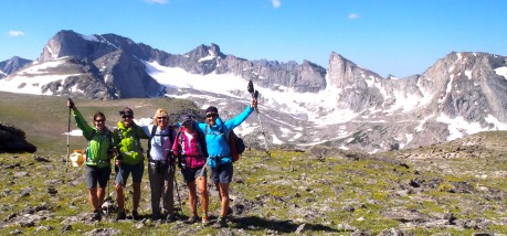
There were six in our group, including Kathy Swanson, Kathy Browning, Leann Sebade and Holly Copeland, and my better half and frequent hiking companion, my husband, Jerry. (Jerry and I had this hike on our life list, but he also generously offered to help me by taking additional photos to capture the magnificence of the day.)
We would start at Dickinson Park, hike the Bears Ears Trail to its end, connect to and hike the Lizard Head Trail to the North Fork Trail, and then head back toward Dickinson Park. The start and finish are separated by two miles of dirt road. If there’s one thing we like to think we are, it’s smart, so we took two cars and dropped one at the end before we started hiking.
The hike, according to the maps we had on hand, indicated the adventure would be about 26.2 miles — a marathon hike. (Turns out the maps were wrong; our trusty GPS, along with the signage on the trails, would indicate that in fact our loop hike measured 29.3 miles.)
The hike would start at 9,400 feet elevation and climb to just under 12,000 feet in places. For much of the hike, we would be between 11,000′ and 11,700′. All told, there was 5,700′ of elevation gain.
In other words, this adventure would be more than a long walk; it would involve some lung-busting and muscle-tearing. The payoff, of course, would be panoramic mountain views that would continue to unfold in front of us for long periods of time, as well as meaningful conversation and a fun time with kindred spirits.
The first three miles are a climb through gradual, but seemingly endless switchbacks through lodgepole forest. Once out of the trees, we were at 11,000′ and hiking in alpine tundra by sunrise. Like I said, by all (continuing) indications, it would be a stellar day.
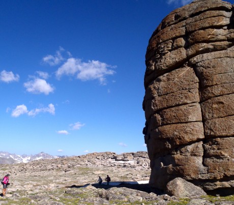
The Bears Ears Trail gets its name for a rock tower formation that looks exactly like a (teddy) bear’s head, complete with its two ears on top. You can see the Bears Ears from various spots in the front/low country we frequent, so it’s a treat to walk right under it and to see it up close.
Early Native Americans, particularly the Shoshone and Crow Indians, frequented this area to hunt for bighorn sheep, and to perform religious ceremonies.
At this point, you can see Funnel Lake, before continuing through a low saddle called Adams Pass before dropping to a bridged (marsh) crossing of Sand Creek.
After crossing Sand Creek, we continued to the right of Sand Creek and ascended a rocky trail. The granite is this area is 2.5 billion years old. It’s hard not to feel insignificant in the spectrum of time when hiking amongst such old rock.
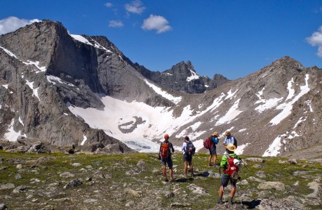
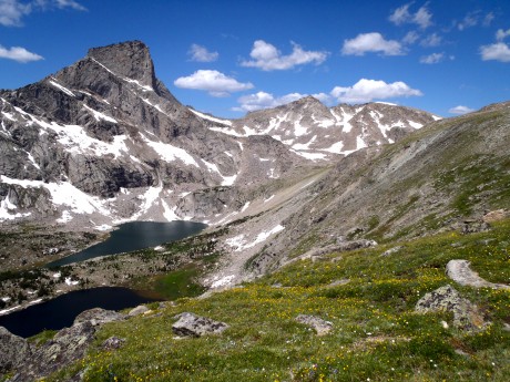
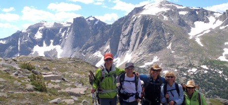
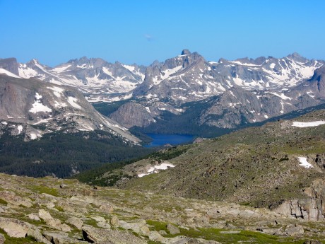
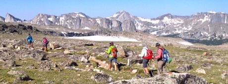
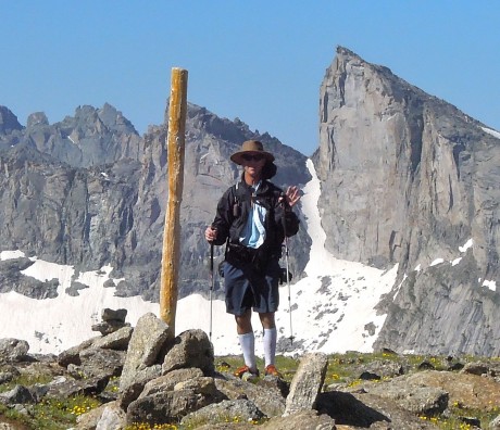
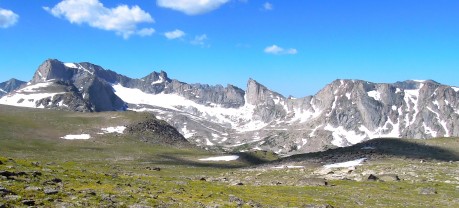
At the seven-mile mark, we were handed our first real prize – a jaw-dropping, awe-inspiring, panoramic view of the Wind River Range. Mount Washakie and Washakie Pass, Bernard Peak, Lock Leven Lake, Chess Ridge, Mount Hooker (with its perpendicular 1,600-foot-tall face), Grave Lake, Mount Bonneville, Musembeah Peak, and more. Imagine a view of towering, silver granite, snow-covered mountain peaks with a scattering of glaciers and lakes and you get the picture.
This is a great turn-around spot for reasonable-but-fit day hikers. Even better, though, would be to do a quick scramble to the top of Mt. Chauvenet, which stands 12,250 feet tall and is right there behind you as you’re taking in these magnificent views of the Wind River Range. Jerry and I climbed it about 12 years ago and I can’t recommend it enough.
We stayed on the Bears Ears Trail and continued up, until the trail crested and we opted to enjoy a short break while taking in the awesome views.
Up next for us was connecting to the Lizard Head Trail. The Lizard Head Trail would connect us to the North Fork Trail. Some of us had previously hiked the Bears Ears Trail, as well as the North Fork Trail, but always on separate occasions and had never linked the two trails. Jerry and I had long wanted to see what Lizard Head Trail was like. In looking at a map, and having climbed the massive Lizard Head Peak in 1999, we knew it could only be awesome.
And boy, were we right about that.
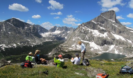
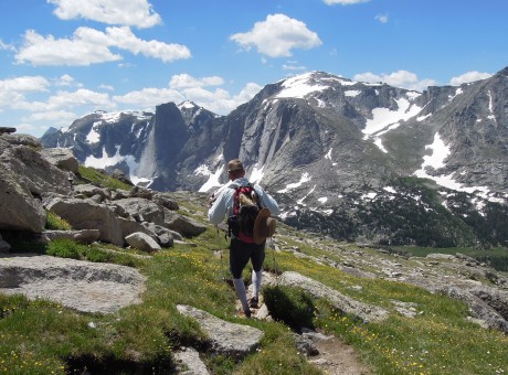
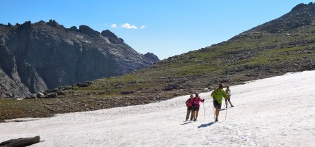
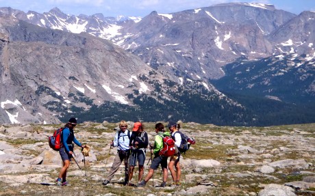
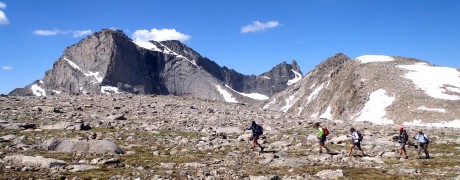
After connecting to the Lizard Head Trail and ascending a snow field, or two, we reached sweeping views of additional sections of the Wind River Range. In fact, for the next several (seven?) miles we hiked on alpine tundra that was littered with an abundance of tiny, fragile wildflowers of all colors and kinds, and lichen-covered rocks while being overshadowed by one granite peak after another to our right.
We’re talking jaw-dropping scenery. The kinds of views that can move you to tears, and, especially given the altitude, take your breath away and leave you speechless. For moments at a time.
I’m usually a swift hiker and we had a timeline to keep for this long hike. But, during this stretch, I “strolled” quite a bit. It was impossible not to. The views were just so amazing and the hiking too enjoyable. The air is thinner on this trail, though. Some of us had faint headaches and I reminded the group — and myself — to take deep breaths to counter the effects of the thin, oxygen-deprived, high altitude air. I, as well as Jerry, and the others, snapped tons of photos along this section. (As you can see from the number included in this post!)
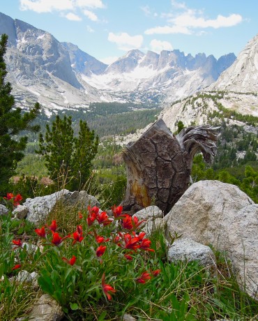
After about seven miles of hiking on the Lizard Head Trail, we were afforded views of the famous Cirque of the Towers. (Yeehaw!) The Cirque of the Towers are an amazing collection of 17 peaks that provides world-class climbing. We could also see Lonesome Lake, which is situated directly below the Cirque.
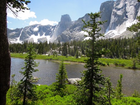
Lizard Head Peak stands 12,842′ tall and is the star of this section of the Lizard Head Trail. No wonder it is the trail’s namesake.  About one mile northeast of the Cirque of the Towers, Lizard Head is the area’s dominant peak. From our vantage we enjoyed a magnificent view of its east face, which towers 2,300 feet above Bear Lake.
Here, with Lizard Head, Bear Lake, the Cirque of the Towers, Lonesome Lake, Mitchell Peak, Lizard Head Meadows and The Monolith as visuals, we stopped for a short break. This now marks the best lunch spot I’ve ever experienced.
Because we were on a timeline, and by now, knowing that the hike would be a few miles longer than the original marathon distance we had anticipated, we started moving again, descending toward the North Fork of the Popo Agie River, where we would connect to the North Fork Trail.
Once we hit the North Fork Trail, we were back in the forest. The trail was more kind — both in terms of grade and terrain. The shade was also nice, given it was early afternoon and we were hiking at a reasonable elevation. Here, many of us (re)lathered ourselves with bug spray and some of us donned head nets. Darn it — the mosquitos were out in force. Fortunately we had all expected this.
Rivers in the Wind River Range were/are raging right now compared to normal, given the abundance of snow and moisture our mountains received this past winter and spring. We knew we had at least four river crossings to contend with but had been informed before our departure that they were all passable. Still, we were a little anxious in anticipation, as turning back was not something we wanted to consider.
It was a few miles of level, fast hiking before we reached the first crossing. The water was swift and hit most of us in the mid- to upper-thigh for part of it. But the water felt great and we all crossed successfully, although some of us did so with more mental ease than others. I’m not a huge fan of river crossings so was glad to have this first one behind us. Reportedly, it would be the worst of the crossings.
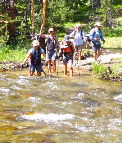
The next one, however, proved to be swifter than our first. We took our time, and again, we all crossed with no more than some anxiety.
Turns out there were three other crossings that required us to de-shoe, but they were easy and the water provided a welcome relief to our tired, dirty, “protesting” feet.
Except for the bugs and the water crossings, in my opinion, the North Fork Trail is a walk in the park. From Lizard Head Meadows to Dickinson Park the distance is 13 miles and the elevation change is a mere 1,000 feet.
That said, as is usual for these long hikes, the last two miles feels like four, if not more. With about 25 miles on our legs, we were pretty much cruising through the forest with little effort. At one point, I asked Jerry, the GPS-carrier, what our elevation was and he said, “8,600 feet.” What? I asked him again two more times and each time the answer was the same. This was a little demoralizing considering I/we knew the end was located at about 9,400 feet.
The character-building portion of the hike (if there was one?) for me, and I’m guessing for the others, was at about the 26-mile mark, where we walked on a dusty, hot trail through a recently-burned section of forest and then had to grunt up a hill for about 1,000 feet only to descend a couple hundred feet and go for what was a couple more miles (that seemed like five or six) to get to the end.
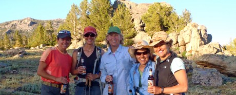
Once at the end, we had cold beers in a cooler (a surprise reward from Jerry), and Kettle Chips and Rainier cherries from Leann. All hit the spot!
But the biggest reward for me, and hopefully for my comrades, is that I had gained an epic experience, memories to last a lifetime, inspiration that will serve as fuel for me, stronger friendships, and a health benefit to boot.
A SHORT VIDEO:
The post This Hike Takes Your Breath Away appeared first on Have Media Will Travel.